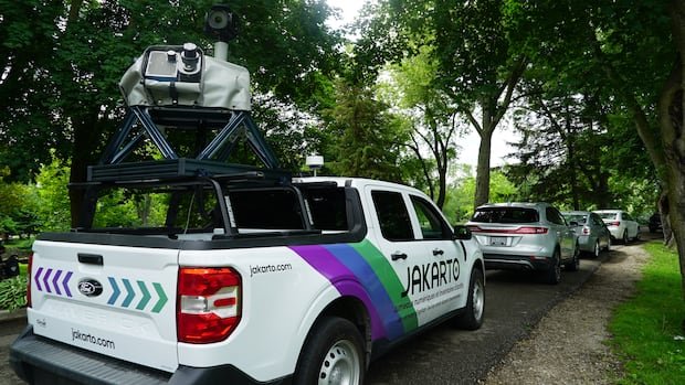

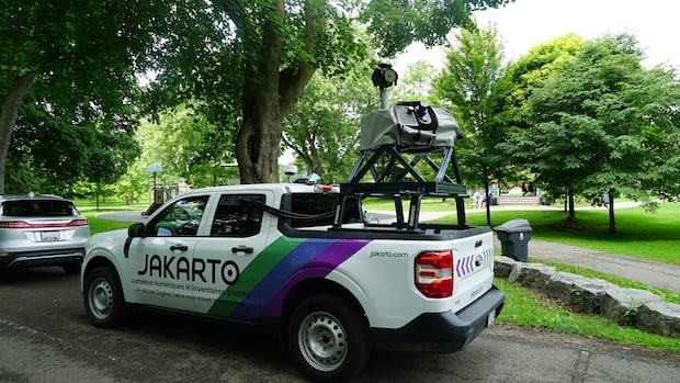

Residents of Guelph have likely spotted trucks resembling Google Street View vehicles driving around with large cameras on top in recent weeks. These trucks are conducting a detailed mapping project to capture millions of laser measurements of trees along streets, aiming to create a comprehensive three-dimensional virtual map of the city’s tree inventory. Dave Beaton, Guelph’s program manager for forestry and sustainable landscapes, emphasized the importance of this initiative in enhancing tree management practices and supporting the city’s goal of achieving 40 percent tree canopy cover by 2070.
According to Beaton, Guelph’s current tree inventory, which is approximately 12 years old, needs updating as trees grow, are removed, or newly planted. The new mapping system will provide more accurate and precise information about urban trees, facilitating better long-term planning and management strategies.
The trucks are equipped with mobile LiDAR scanners that capture detailed measurements of trees, including height, trunk diameter, canopy size, and location as they traverse different neighborhoods. Additionally, they collect data on nearby infrastructure such as signs and hydrants. The project is a collaboration with Jakarto, a Quebec-based mapping company.
Felix LaRoche, the founder and CEO of Jakarto, highlighted the precision of their data collection process, noting that they capture two million measurements per second to generate a highly accurate digital twin of the city. The scanning trucks operate solely on public roads and do not access private properties, ensuring privacy by automatically blurring license plates before sharing the data with municipal staff.
The collected data will aid in identifying optimal planting locations, enhancing long-term planning efforts, and targeting areas with insufficient tree canopy cover. Within two months, Guelph is expected to have an updated tree inventory and a 3D virtual map of urban trees and public infrastructure, a process that would have been significantly more time-consuming using traditional methods.
Advancing Digital City Modeling
The digital twin map is an advanced virtual model of the city that provides detailed insights into the urban environment. LaRoche described it as a replica of the city that includes essential tools for city staff to conduct measurements and inspect infrastructure without physical fieldwork.
This technology is also being utilized in Cambridge for planning and development purposes. Hardy Bromberg, Cambridge’s general manager of planning and growth, explained that the combination of existing aerial 3D mapping data with new street-level scans enhances the city’s planning capabilities, facilitating a better understanding of proposed developments in relation to surrounding neighborhoods. The enhanced digital twin is expected to be publicly accessible later this year, streamlining development processes and enhancing public awareness of community changes.
Striving for a Sustainable Urban Canopy
Recent estimates suggest that Guelph is home to nearly three million trees and requires an additional 3.6 million trees to achieve the 40 percent tree canopy cover target by 2070. Beaton emphasized that the collected data will expedite tree planting initiatives across the city, contributing to Guelph’s resilience against climate change by providing more shade and cooling options for residents.